Friday, August 3, 2012

Day 112...Rouses Point to anchorage near Valcour Island, Lake Champlain

THURSDAY, JULY 19, 2012
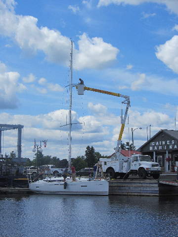
     We knew we were going to start late today because we only had about 27 miles to our anchorage for the night.  We spent some of the time watching them step the mast of a new sailboat that pulled into the marina.  Gary said the winches were still wrapped in foam and tape.  The marina brought in their bucket truck to life the mast into position.  They lifted the mast and then slid it over to where it fastens to the top of the boat.  By then it was after 11:00 a.m. and we thought we better head out so we didn't get to see them finish.
     After we left the marina, I took one picture of Lake Champlain with the Green Mountains of Vermont on the left and the Adirondacks of New York on the right.  Then separate pictures of Vermont and New York.  Lake Champlain is about 109 miles long.  The real lake portion of Lake Champlain is about 71 miles long and the remaining 38 miles is more like a river.  Some sections of the lake are over 9 miles wide.  Most of the lake is deep to the shoreline, and there are places in the lake that are over 200 feet deep.

     In the distance there were mountains, mountains and more mountains for the entire day.
     We saw some huge ferries that crossed from Grand Isle, Vermont to Plattsburg, New York.  They were doing a thriving business moving the people and vehicles back and forth across Lake Champlain.
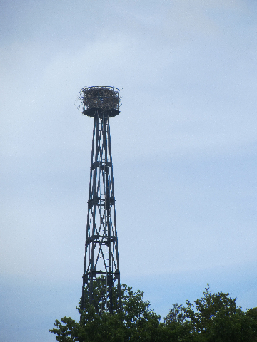
     There were rocky cliffs at Bluff Point before we turned the corner to enter our anchorage off Valcour Island.  The 35 foot tall Bluff Point Lighthouse was built overlooking the site where, almost 100 years earlier, the first naval battle of the Revolutionary War, known as the Battle of Lake Champlain, was fought.  The blue limestone rock lighthouse stands 95 feet above the lake and can be seen for 18 miles. A skeletal tower with an automatic light replaced it for a time.  The tower now is home to a big bird’s nest.  I couldn’t tell what kind it was before it soared off.
     In the cruising guide they said that the anchorage we chose, Bluff Point South, was a VERY popular anchorage that sometimes has 20-30 boats anchored there on a weekend.  Well, this was Thursday and by the time we went to bed Gary had counted 37 boats including us in the anchorage.  I’d call that crowded.  We traveled 28 miles in about 4 1/2 hours.  Our total miles is 2141 now.

Wednesday, August 1, 2012

Day 111...Chambly to Rouses Point, New York, USA

WEDNESDAY, JULY 18, 2012
     We got up ready for quite a few more locks and bridges today, but we’ll be back in the states before the end of the day. You know we were up at our regular 6:30 a.m. time but since the locks don’t open until 8:30, we walked to the grocery store for one last look around before we left the wall at 8:30.
     Each of the first four locks is only one tenth of a mile apart. They are so close that they can get ready for you by simply looking at the previous lock.  Since we had already come up Locks 1-3 day before yesterday, Lock 4 (up 7 feet) was already almost ready for us when we arrived.  As with the first three locks, in these locks the staff drop you ropes to hold on to.  We only had to share Lock 4 with a family of ducks.  We found out that they hang around the lock because the lockmaster feeds them.  I'm not sure that it is a good idea to have them dependent on someone feeding them.
      Here are Lock 5 (up 8 feet) and Lock 6 (up 8 feet).  They look almost exactly the same don't they?  There was nothing exceptional to write about them.  They were just normal.  As usual people by the locks asked us questions about Florida.  It was nice talking to different people along the way. 
     OK, let's talk about the crooked pictures.  Many times the boat is bouncing around so much that I'm lucky to be able to take a picture at all.  A lot of the time we are coming up to the lock at an angle and I have to lean out of the door and try to get the picture before I have to go to the stern of the boat.  Sometimes I can't see the camera screen because of the sun.  Other times I just forget to make sure I get a straight picture.  If I think about it I do try to get at least one picture that is even.
     Lock 7 (up 7 feet) was next.  The walls of two of the locks had stone at the top and logs at the bottom.  I thought they were interesting.
     When we got to Lock 8 (up 9 feet), there were two ladies at the lock.  After we locked through, we had to wait for the younger lady to go open the swing bridge.  While we were waiting, I was talking to the older lock lady.  She had very short hair and I told her I liked it.  She said that she had previously shaved her head to support a co-worker whose hair had fallen out after chemotherapy.   
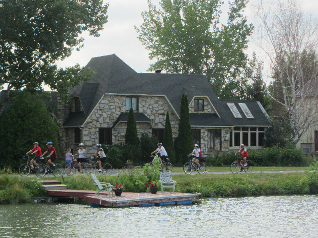
       There were bike paths on the port side of the boat.  They were able to go much faster than us.  This wasn't even a weekend and there were tons of cyclists on the path.

     Three of the bridges were worth photographing.  The first is a simple tall, silver swing bridge, the second a blue bridge that lifts from one end and the last is a low, bluish-green swing bridge.   
     These look like raindrops right?  Well they aren't.  They are flying bugs that swooped down into the water.  We ran through a swarm of thousands of them. 
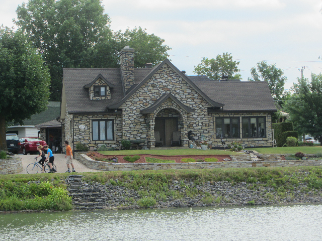
     Houses lined the canal.  Here are three of the nicest ones.
     Many of the citizens of Quebec choose to fly the Quebec flag rather than the red and white maple leaf Canadian flag.
     As we continue down the canal, we saw the Richelieu River running parallel with the canal on the port side just beyond the wide bicycle path. 
      Next was our last lock in Canada.  Our timing for the Saint-Jean-de-Richelieu Lock 9 (up 5 feet) couldn't have been better.  The Gouin Swing Bridge immediately beyond the lock only opened for 10 minutes between 11:45 and 1:15.  We were so lucky we were there at about 11:40.
After we passed under the swing bridge, we joined the Richelieu River.  It is just beyond the concrete slab things.
     Our next stop would be in the USA.  We traveled on the river for about 19 more miles before we reached Canadian Customs and then the US Border. 
       Fort Montgomery is built on the original site of a previous fort called Fort Blunder by some because the first American fort was found to be built in Canada after a second land survey.  After the land was given to the US, Fort Montgomery was built.  Now it is almost a ruin.
     We saw a bridge and blinking sign in the distance but thought work was being done on the bridge and the sign was an informational sign regarding the bridge work.  Not for a moment did we think the "construction" trailer was the US Customs Office until a woman came on the radio and told us to head to the dock to check in.  The customs officers were very nice.  The woman said that since the river froze completely during the winter effectively stopping the boat traffic; they could pack up the sign, the trailer and the dock  and take it away until spring.  There was no need for expensive permanent structures. Makes sense to me.
     After checking in with customs, we went to Gaines Marina at Rouses Point, N.Y. to spend the night in a slip for a change.  No more lock walls.  I should've asked about a Boat US discount, but was out of the habit.  I cost me almost $10 because you know they didn't mention it to me.  Well I'm back in the habit now.  I'll sure ask from now on.  It was a very nice marina.  Boy, we do love those hot showers.
     We traveled 35 miles today in about 7 hours.  Our total is now 2113 miles.